There are currently 4 types of markers that can be displayed on the map. Each will have a set of configurations that can be made. [BASIC; CIRCLE; PIE; DIRECTIONAL]
The following properties are available on ALL marker types:
Layer: What layer this marker belongs to
Location: The Latitude and Longitude of the marker
Tooltip: The text that display when the marker is hovered; this is also called the “label”
Timestamp: A date time associated with this marker – this value is required for date filtering; empty values are ignored
Opacity: Sets the level of transparency of the marker
Notes: Any additional details associated with this marker
Linked Images: External images can be “linked” to this location
Reference Links are available for markers as well. These include “Reverse Geocode”(Get nearest address from location) and “Street View” (This opens a browser into Googles street view service)
*Not all locations will have an associated street view.
Here is the “Basic” marker form
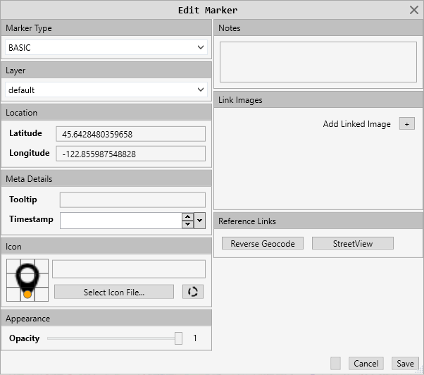
The basic marker allows you to set the icon the marker will display on the map. See Icon Configurations
Here is the “Circle” marker form
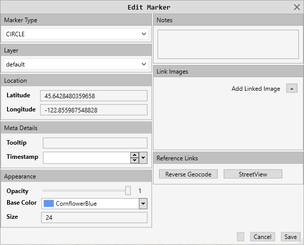
This form adds “Base Color” and “Size”
Here is the “Pie” marker form.
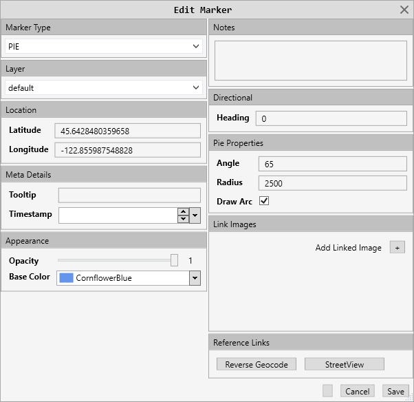
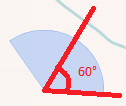
This form adds:
Base Color: The color the marker will be drawn in
Heading: This is the direction the “center” of the marker will face
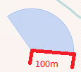
Angle: This is the beam width from the heading to the extent of the arc
Radius: value in meters from origin to end
Draw Arc: Whether or not to draw the finite line or display as a fade
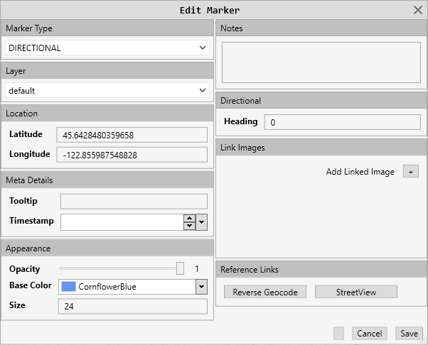
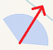
Here is the “Directional” marker form
 This marker has a heading of 30° and a size of 48
This form adds:
Base Color: The color the marker will be drawn in
Size: How large the marker will appear
Heading: This is the direction the “point” of the marker will face