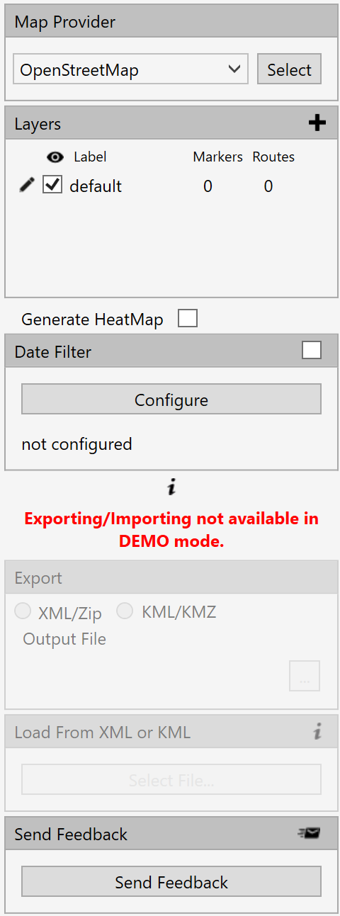
The menu is used for managing the map settings and marker details.
While this menu is OPEN, the map and markers cannot be directly accessed.
Menu Option Definitions
Map Provider: This setting determines what the map will look like. See the available map list below,
Layers: Markers are organized in “Layers”. This allows you to edit details that will be applied to marker on that layer only. Layers contain markers and routes.
Date Filter: Filter markers on the map by their timestamp
Export: Export map data to XML for sharing maps with other MapLink users.
Load from XML: Load and exported XML.
Send Feedback:
Registered To:
Map Options List - Currently MapLink offers the following map choices:
•ArcGIS Imagery World 2D Map
•ArcGIS Street Map World 2D Map
•ArcGIS Topo US 2D Map
•ArcGis World Physical Map
•ArcGIS World Shaded Relief Map
•ArcGIS World Street Map
•ArcGIS World Terrain Base Map
•ArcGIS World Topo Map
•Bing Hybrid Map
•Bing Map
•Bing Satellite Map
•Google Hybrid Map
•Google Map
•Google Satellite Map
•Google Terrain Map
•Open Cycle Landscape Map
•Open Cycle Map
•Open Cycle Transport Map
•Open Sea Map Hybrid
•Open Street 4U Map
•Open Street Map
•Open Street MapQuest Map
•Open Street Mapquest Hybrid Map
•Open Street Mapquest Sattelite Map
•Yandex Hybrid Map
•Yandex Map
•Yandex Satellite Map