The Mapping feature is a utility that plots data points from CDRs/telephone tolls, cell tower dumps, points of interest, addresses, etc. It can be taken completely offline and retain full functionality. Several of the functions are also described in the Manual Plotting section of Chapter 8.
Mapping is done in layers and the layer stacking can be adjusted in any order. Individual points in each layer can be arranged and connected with lines to show connections or patterns. Radius markings and pies can be added to points for triangulation plotting. Custom icons and notes can be added to points for clarity. The Map pages can be saved, printed, or exported to a KML file for importing into Google Earth.
Initial View
The initial view of the Mapping main screen shows a starting page with “Load” and “Save” buttons at the top right. Click <Load> to load saved maps into the report for additional edits The dropdown bar shows the default map, “Open Street Map”, or click on the bar to select from a variety of different maps available. Click <Set> when the selection is made. To move the map on the screen ”right click and drag” the map to the desired location.
| Use the Layers controls to import tower records add or edit layers once the map is selected. |
•External Layers is used to add selected layers, developed from different sections of DART, to the map
•Date Filtering enables the operator to see the pattern of movement in chronological order, as points are plotted on the map.
•Network Options provides the option to use Mapping online or offline.
•Zoom Control is used to zoom closer to or further from a point on the map.
•Geocoding Utilities has two options:
oGeocode an address to plot a known address on a map.
oReverse geocoding provides an address for the latitude and longitude entered.
•Export as KML converts the map into format that can be used by Google Earth and other mapping programs.
•Proxy Settings is used when operating a device going through a Proxy Server <Save in Database> and <Load from database> (upper left) are used to place or retrieve map data into or from the database.

The tool panel can be “collapsed” off the map by clicking on the grey bar along the far right edge of the map. Click the bar again and the tool panel comes into view.
The small box in the upper left corner of the map provides short cuts to:
i.Add Tower beams
ii.Add markers
iii.Add paths
iv.Add arrows, balloons, and callouts
Click the envelope icon in the lower left corner to contact the HTCI lab with feedback regarding any issues, bugs, new requirements, or suggestions for additional tools. Enter your e-mail address and a detailed message. For issues and possible bugs attach a screen shot to assist the tech’s. This e-mail goes directly to the primary program developer.
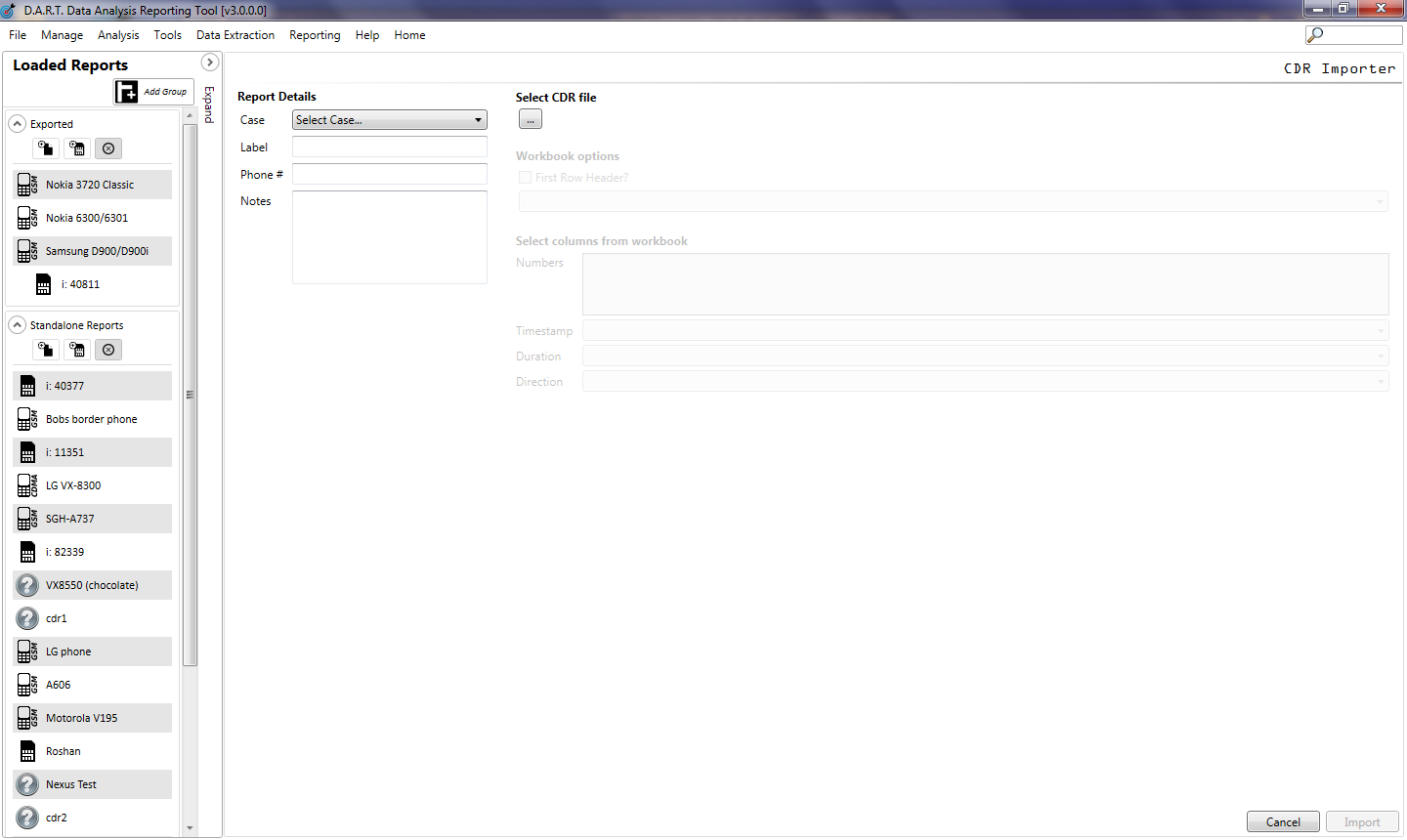
To load the CDR file into DART click <File> then select Load CDR. Select the case the file is associated with, enter a label, then locate and select the CDR file desired.